County Map of Texas - 1895 - Fine Art Print
Texas in Her Full 19th Century Glory
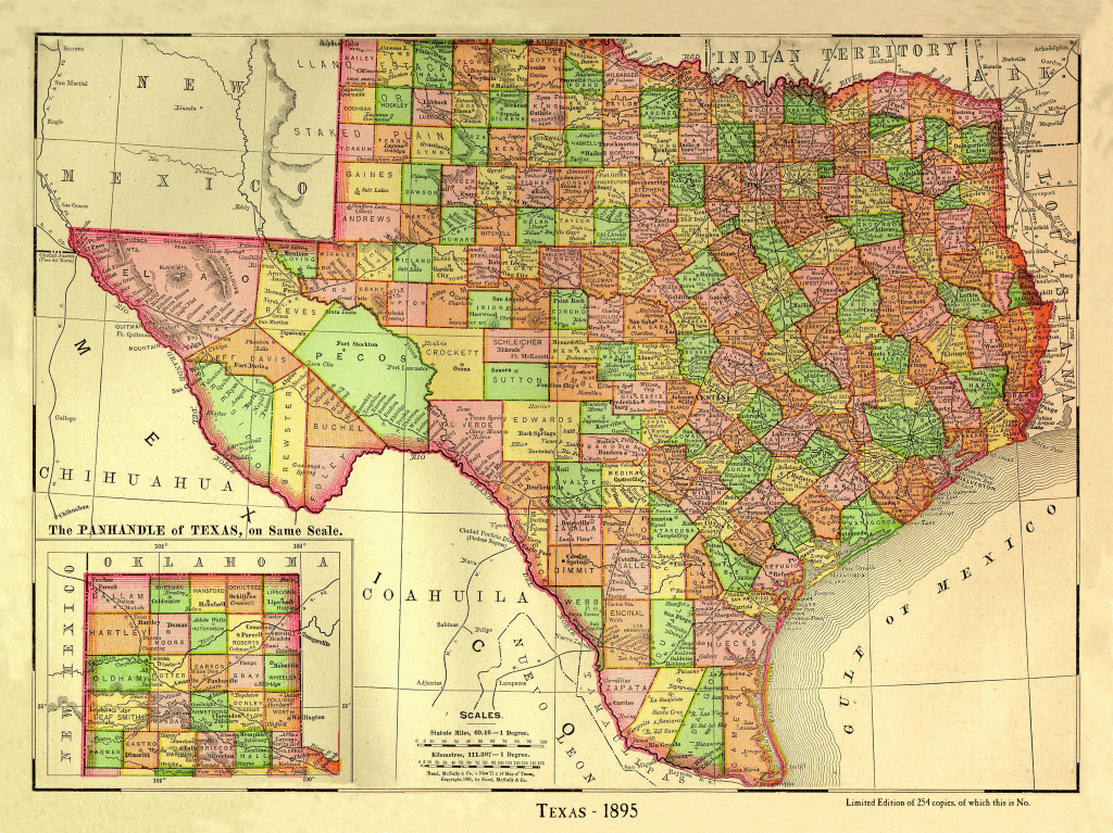
By 1895, the singular shape of Texas that the world recognizes today had been whittled out of the much larger Republic-era shape. The original twenty-three counties of the Republic had divided into a whopping 248. It would be another twenty years before we’d reach our final count of 254.
You may not recognize some of the counties on this map. Foley & Buchel Counties out in the Big Bend, for example, don’t exist today. Encinal, down in RGV? Gone. Absorbed by Webb County. Counties like Kleberg, Jim Wells, Kenedy, Jim Hogg and Willacy hadn’t been created yet.
This is a colorful relic of Texas, sixty years after she was born, still trying to get her massive lands in order..
Physical Details
- 24 by 18 inches
- Limited Edition of 254 Copies
- Each one is hand-numbered
The paper is acid free, cold press cotton watercolor with an elegant lightly textured finish. This surface allows the inks to 'bite', reproducing the shading and tonality of the original map vividly, beautifully, and exactly.
The inks are guaranteed color-fast for 80 years, which means you won't need to lay out the extra money for UV glass. You can hang your map in direct sun and it will be just as bright when passed on to the next generation it is the day it ships.
It's an instant heirloom. Get yours before they're gone...and get one to give to a friend. He'll owe you!

